The Stones in the woods
If you would like to visit, please contact Andrew Lazenby at joemess2@gmail.com
I will be glad to take a wallk and discuss the cemetery and history of the area with you. Recent media coverage can be found at
https://www.youtube.com/watch?v=FK4w9KfIAkw&t=10s
and at
https://www.youtube.com/watch?v=0ryIfyQuSqA

The story so far in three parts…..
Part1: The Discovery
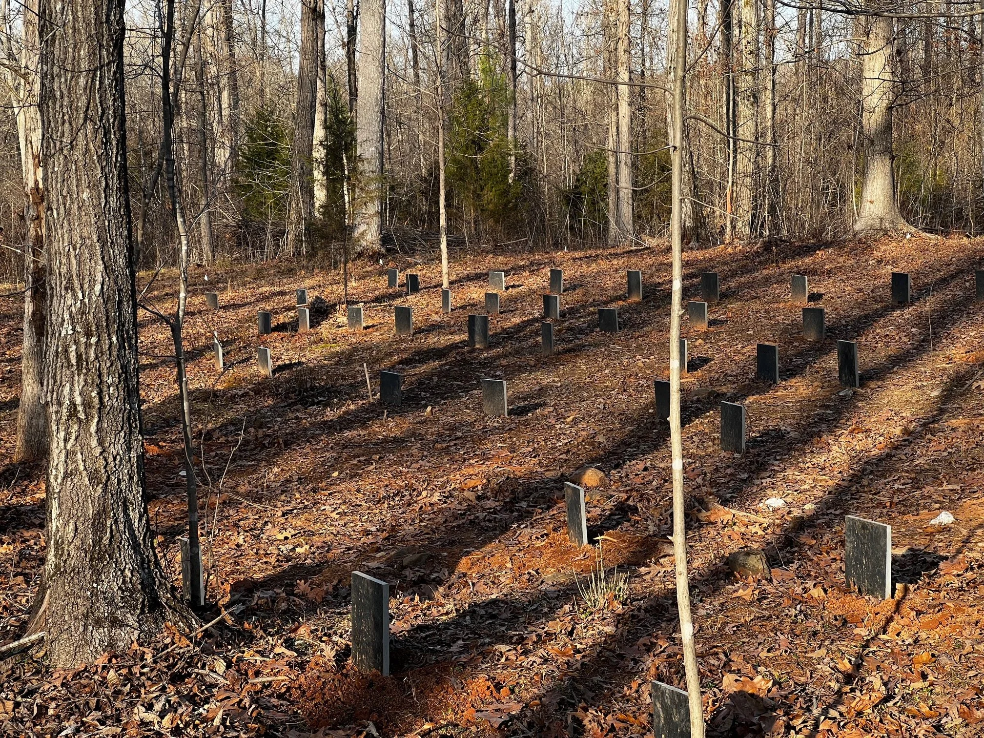
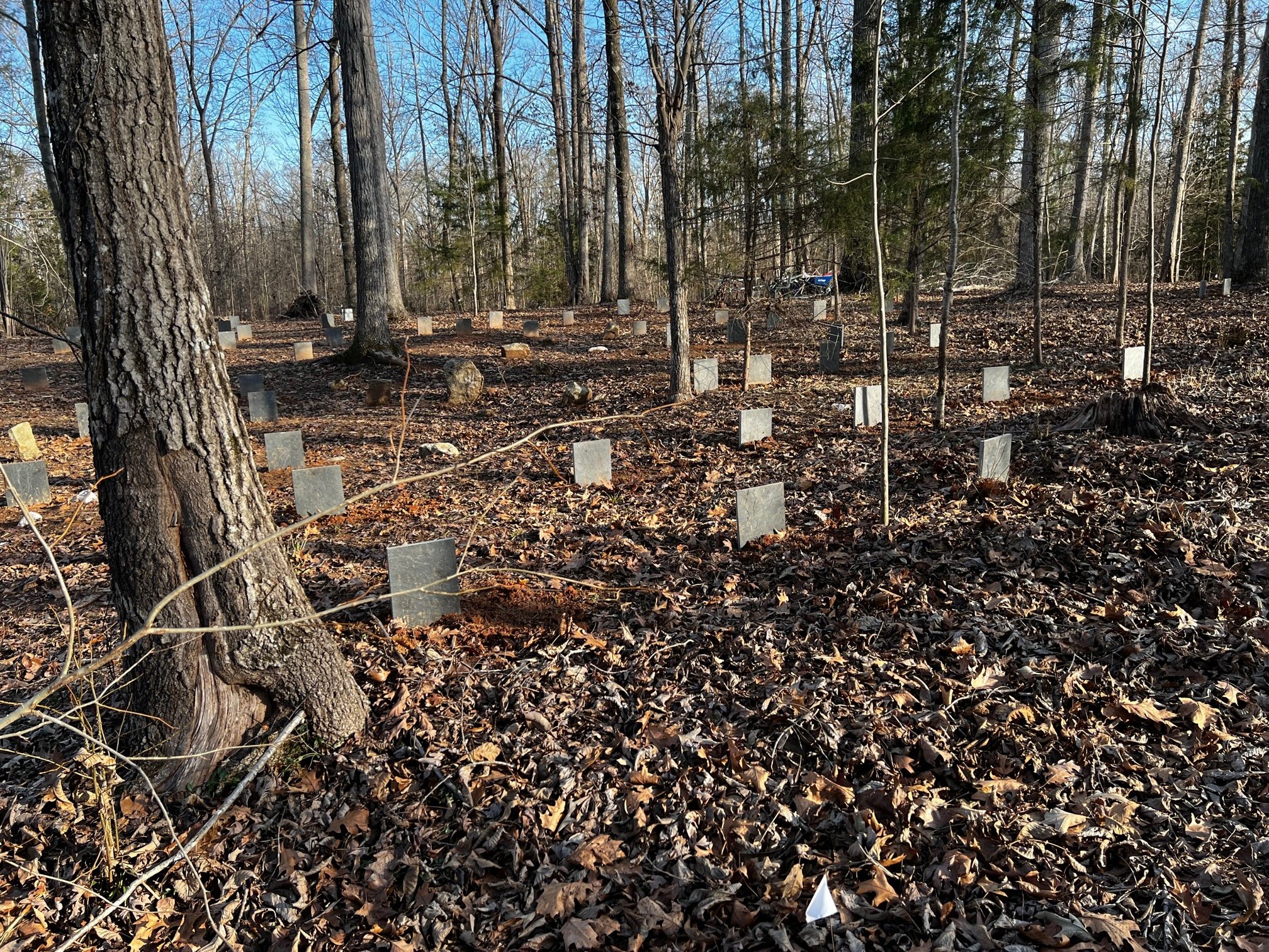
In October of 2021 we found a local property that we were interested in purchasing in order to build a new home for our family. When we first walked this property the previous owner, whose family has owned this land since the 1950s, the presence of a cemetery on the property was briefly mentioned. Due to time constraints, we were not able to find it that day, but after we put it under contract, Mary and I went back to the woods and did a thorough search. Our first clue we may have something was when we found a small ground plant called periwinkle (Vinca minor) that is often found in old cemeteries and homesites throughout our region. This groundcover was very widespread and covered multiple acres so while it indicated that something may be there, it did not do a great deal for pinpointing the actual site. After a bit of bushwhacking, we finally found a small grouping of what we assumed were the headstones hidden in an amongst the scrubby trees and bushes. We counted about 6 initially, but as we glanced around, we could see more and more stones totaling 15-20.
As you may imagine, we were excited but dear lord it was hard to get with the underbrush and we knew we would need to clear the area. We began to look at the stones we could easily see and noticed a few of them had a single letter carved into them. We could easily see an H, T, or I and maybe if you squinted just right, a C. Other than those markings, there was little else giving any identity to who may be buried….
On our own we began to do research in an attempt to find out more of the story for this area and the first place I went to York County’s list of abandoned cemeteries and lo and behold, it was not on the list. Because of the special protections the state and county have on these sites, we contacted the correct individuals and told them what we had…..and the initial reaction was “oh people find rocks in the woods all the time and they are normally nothing”…. THEN I showed them a video of the site and they got MUCH more interested. We double checked the list and map in the County Historical Office and as suspected, it was not on there so we scheduled a site visit. Before the visit, we decided to do a bit of clearing and as we did, we noticed more and more depressions…. And stones…. The 15 turned into 40 which then turned into 80+ possible graves….
The local historians and archeologists came out and were gob smacked at the size of it. We all began to do research on past owners, and initially we thought we could trace ownership back to about 1890 . For anyone who has ever tried to do research into the history of land use, it can get rather tricky as there are skills and knowledge of what iformation you need and where it might be tucked away. We found plenty of interesting leads, but we had level of surity in regard to the accuracy of the information. We had hit a wall…. Then out of the blue another local historian decided to take it from the beginning of the records and procduced the Royal Land Grant from 1760 that gave the land to a family named Harden. Oddly enough, one of our property lines is the same as on the grant which was pretty cool to see. (the total grant was over 1000 acres and our portion is ~100) NOW we were getting somewhere….
Still though, we did not have the story of the cemetery. We had a pretty good idea of what it is, but it has not be definitively proven so we were / are still keeping an open mind. We did know there is no church associated with this site, it was situated between multiple large plantations, and the graves are estimated to be from the mid 1700s to the mid 1800s. We did not have any or enough revolutionary battles or civil war battles to account for this many graves and the families who owned the land are buried in the large Presbyterian Church that was founded in 1750…. So, beyond that information, we don’t know a great deal about the history.
UPDATE SUMMER 2022
The land in York County near Fishing Creek and what is now Gordon Rd. was initially granted to John Harden in 1776 Samuel Lowry acquired the land in 1823 and it stayed in the family for nearly 125 years. From 1823-194 it was home to the Lowry family and their antebellum plantation. Using the forced labor of the enslaved, the Lowry family successfully farmed cotton prior to emancipation. Census data shows that in 1860 there were approximately 60 enslaved being held on the Lowry plantation with a reported 101 enslaved released at emancipation. Historically cotton planting, cultivation, and production was one of the more dangerous occupations that were undertaken in the southeast during the period of slavery. Based on the 144 graves, the mortality of those enslaved was in line with the national mortality rate as put forth by historians of ~10%-15%.
We have been able to locate and communicate with some of the descendants of those interred at Fishing Creek Place cemetery. We chose the name “Fishing Creek Place” as we felt that this was able to honor those who are interred here while not celebrating the name of the plantation that they were forced to work on. Slavery and the ripple effect it has had on our society is a dark stain on our history and should not be forgotten as it would discount the work and effort of those who built our country. Unfortunately, records do not adequately tell the story of those forced to labor on this plantation prior to emancipation thus we have very few names of those enslaved. The few names and descriptions we do have come from wills and marriage decrees of the Lowry family as well as a few newspaper articles placed in an effort to apprehend someone who had escaped captivity.


Part 2: The Search….
We reached out to various local organizations whom we felt would have an interest in this project, at least at an academic level, and were dismayed to find there was very little drive to figure out the story. We understood budgets and time constraints could be playing a role, but beyond a cursory “yeah that’s interesting” very little movement was made and calls were not returned. Time to go to plan B. After speaking with a few individuals who had a personal interest in historic cemeteries, we were put into contact with a private archeology group who would be willing to help and we contracted with them to do a GPR (Ground penetrating radar) search as well as dig deeper into the historical records.
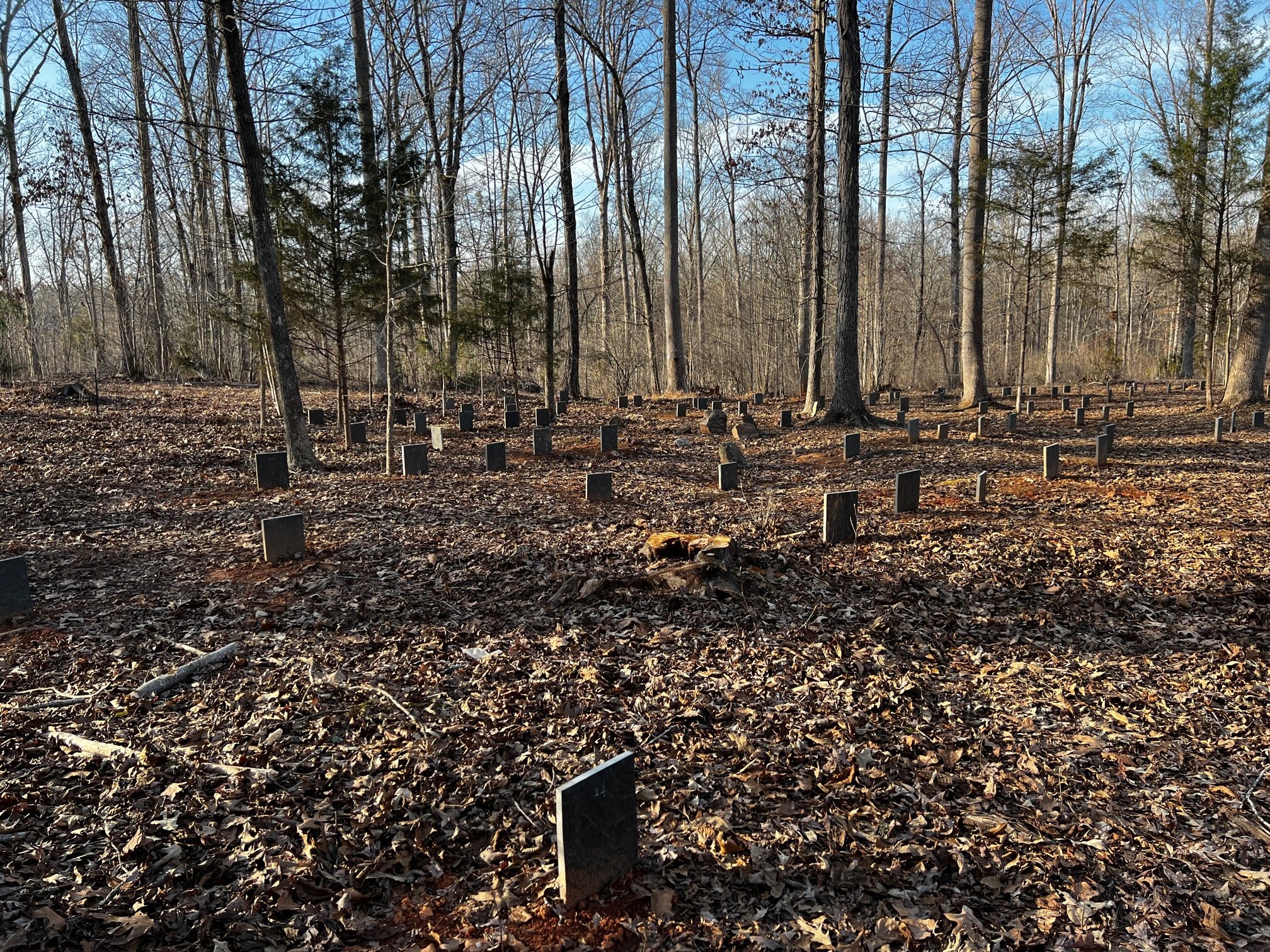
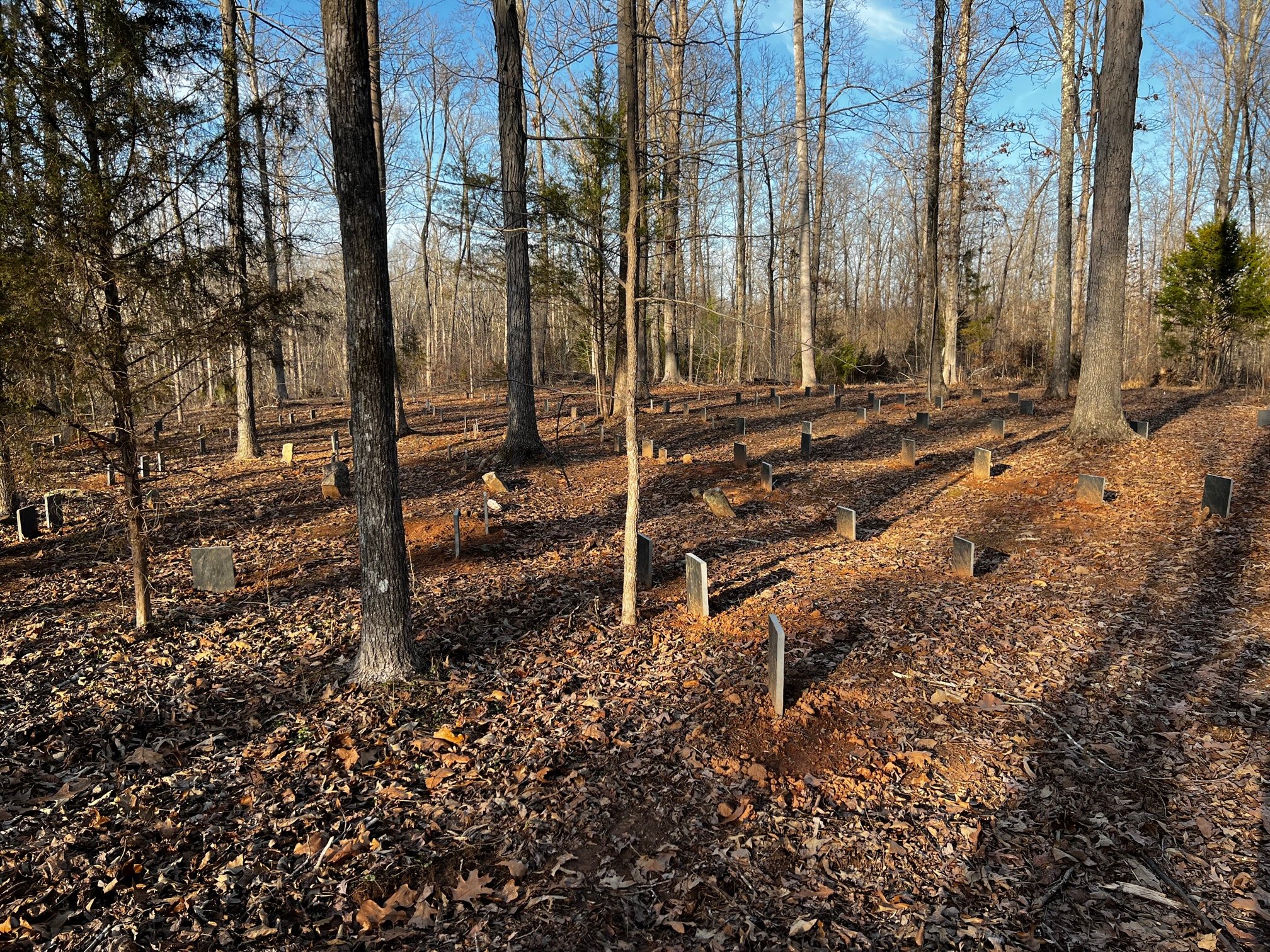
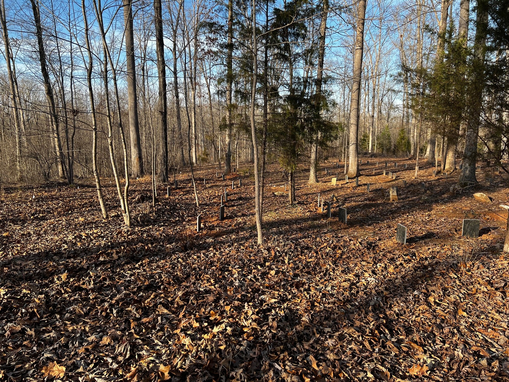
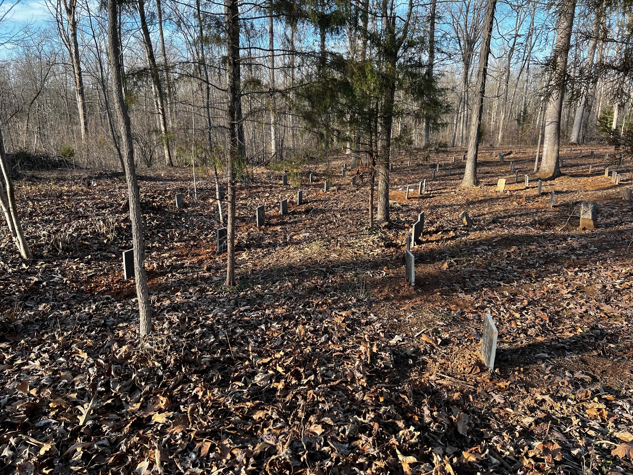
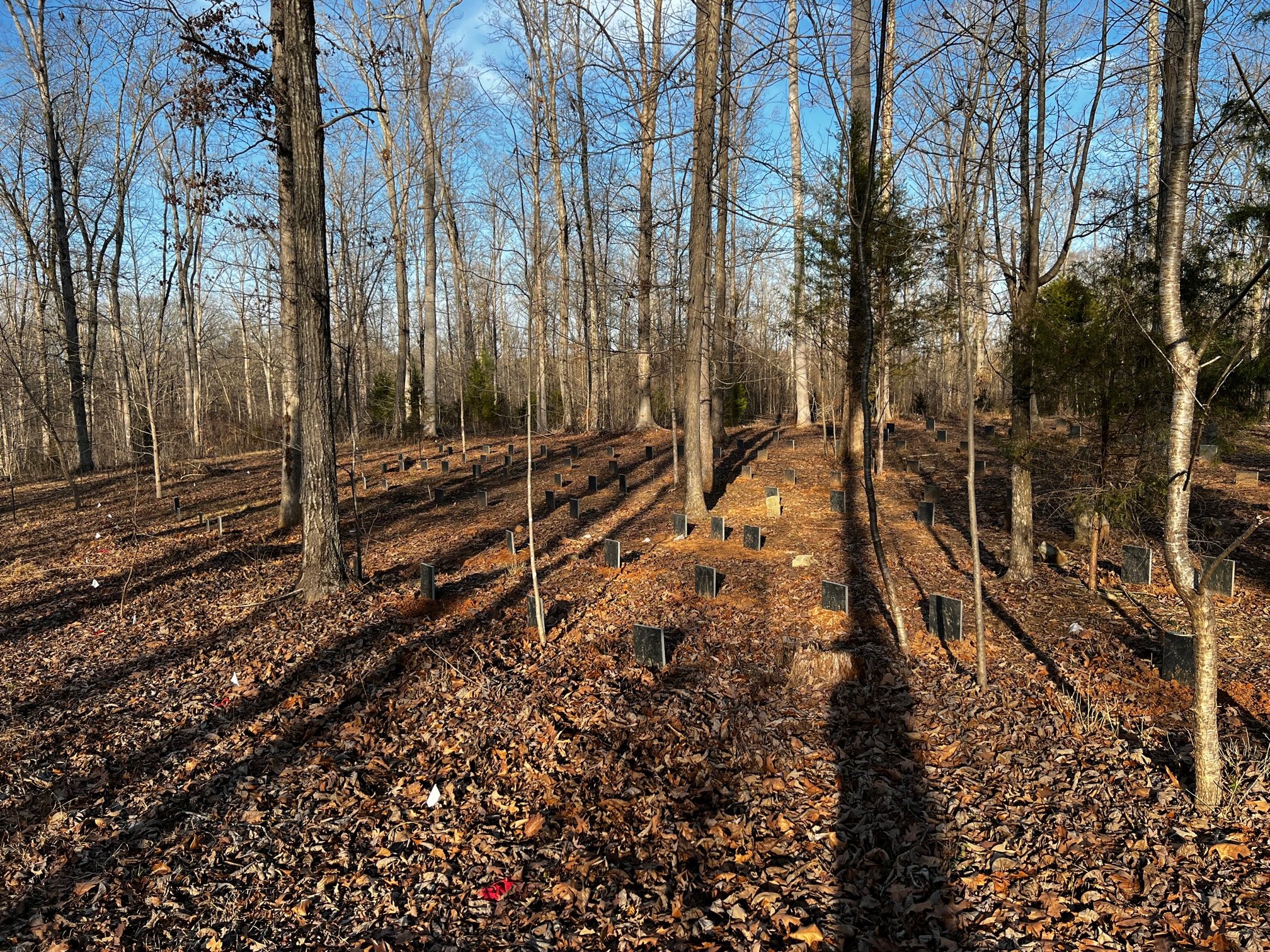
For phase 1, we chose a 100’X100’ area to do the initial mapping in as it met the criteria of being an area that we could cover in the time allotted, contained the majority of the suspected gravesites, and would allow for mapping with enough granularity to be useful. As of the end of this effort, the final count for this area is 122 confirmed graves. These were mapped via GPR by making numerous passes from different directions. Each grave has been assigned a number that relates to the map we created as well as will be impressed into a brass tag and attached to a short piece of rebar. This will be buried at the corner below grade. This is vital as this site is being assigned an “archeological site identifier” though the state. The state archeologist will receive a copy of the report as well as any maps. Metal detecting of the surrounding area turned up square headed nails that are suspected to have been made in the late 1700s to early 1800s as well as other assorted artifacts. (many unrelated such as logging chains, ax heads, and shotgun shell brass showing some of the uses of this area from the time of the abandonment until today)
The contracted archeologist along with the county historical office were able to generate a list of the owners from 1766 until present as well as the number of enslaved people on the plantation associated with this land based on census data. In 1860 there were 72 reported enslaved people present. While we will never know 100%, we have high confidence this is an enslaved peoples cemetery. This is of course subject to change if additional or differing information comes to light. The goal in the end is to tell its story no matter where it leads. We are currently reaching out to the descendants of the families who owned the property to see if they have any additional information we can glean. We know some of them have extensive family histories recorded and are interested in the story as well. We will of course keep sharing what we find as we find it in a respectful manner to those who are in the graveyard or have family history of ownership.
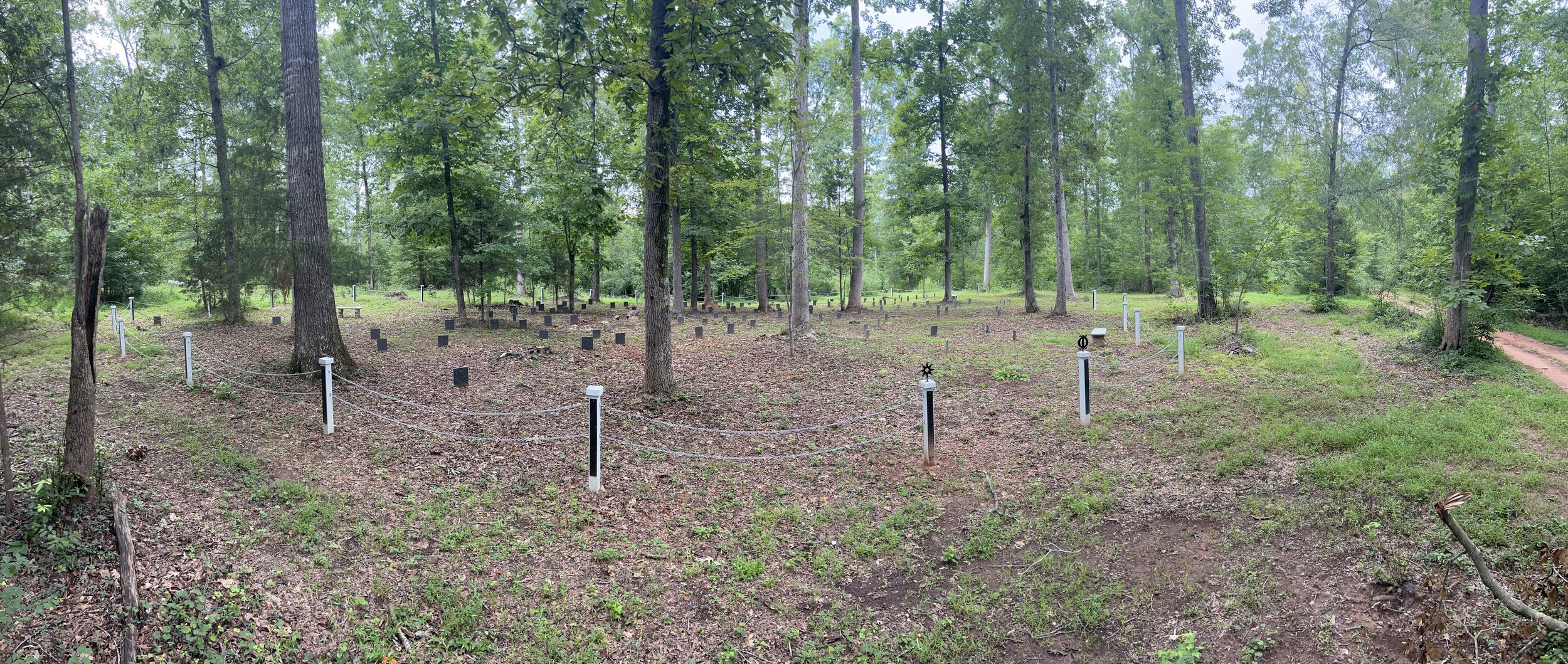
After the initial search turned up 122 graves, we suspected there could be more in the area outside the intial 100’x100’ area. When they were able to, the archeology firm returned and were able to identify 22 additional graves bringing the total up to 144. While we are certain that there are more; time, disturbance, and land use has made them to difficult to identify with any degree of certainty.
Just to address a couple of questions that people were curious about and asked privately. We are following all state laws regarding investigating a historical site. The firm we have hired has extensive experience mapping old and abandoned cemeteries from the colonial period and are following all best practices. The two gentlemen that ran the GPR have been working in recent years with the Gullah -Geechee community along South Carolinas barrier islands to identify and map their cemeteries. While it would be wonderful to work with universities on this, and we reached out to numerous in the state, lack of interest resulted in our search for a private firm. As we have said many times, our end goal is to respect and if possible, give an identity to those who are interred there. We are not making any decisions lightly or without significant forethought.


This is a rendering of the Phase 1 map for the cemetery. Name and location data has been redacted for privacy.


Part 3: The future of the site
Now that we have a greater understanding of the scope of the cemetery and are confident in the locations of the graves, we are makeing decisions in regard to this areas preservation and protection. First and foremost, a conservatiopn easement is being placed on the entire property to prevent development from disturbing the cemetery for perpetuity. We are continuing to reach out to family members of members of our African American community who share the same last name as the plantation owners.
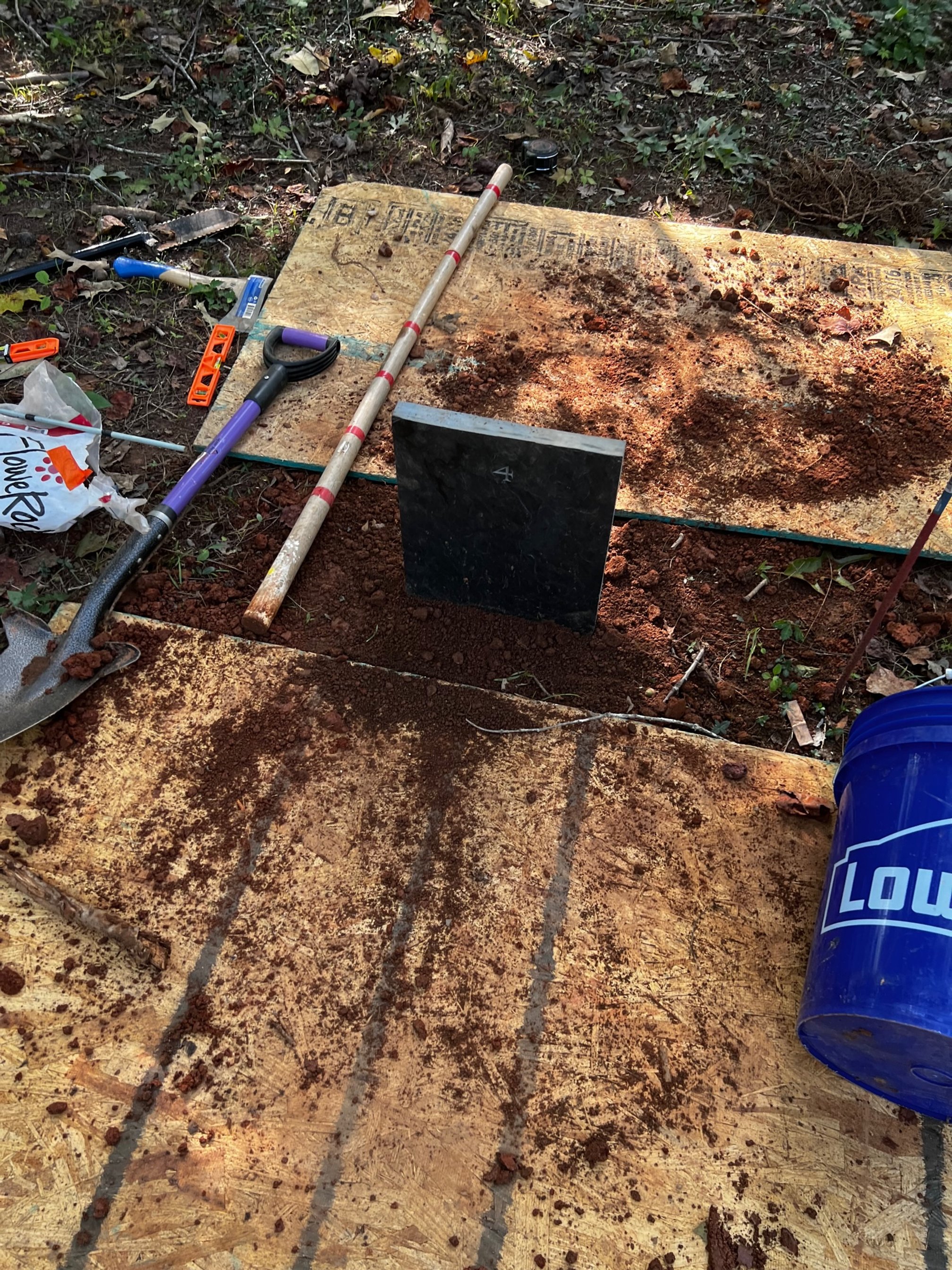
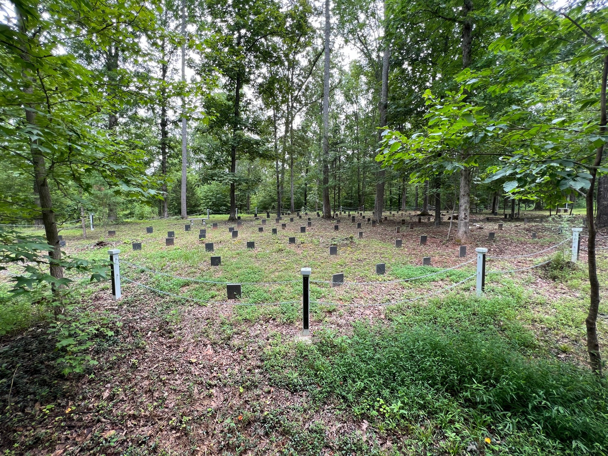
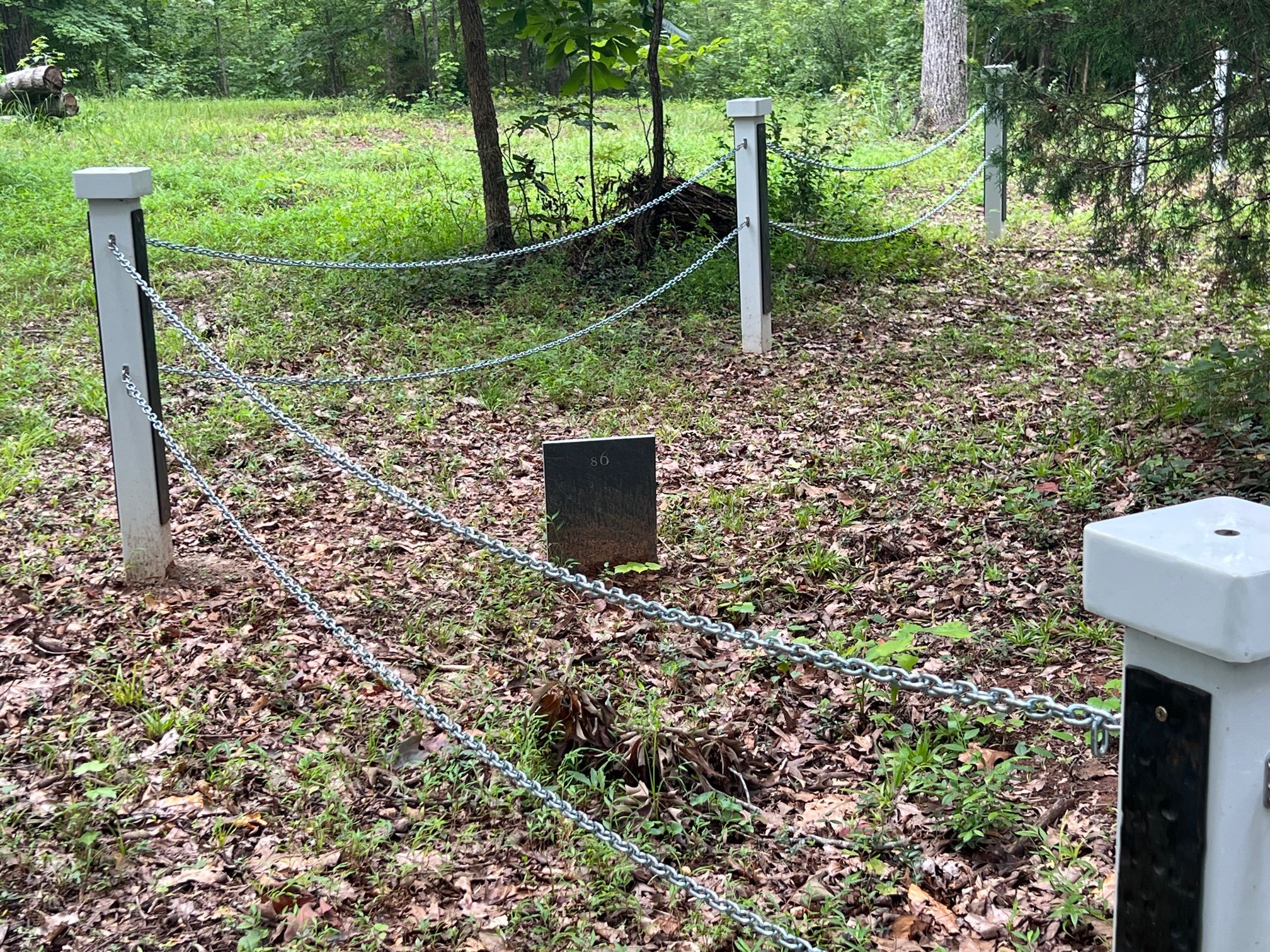
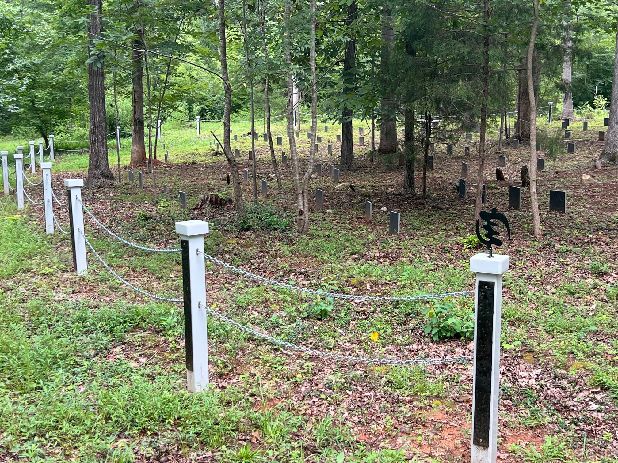
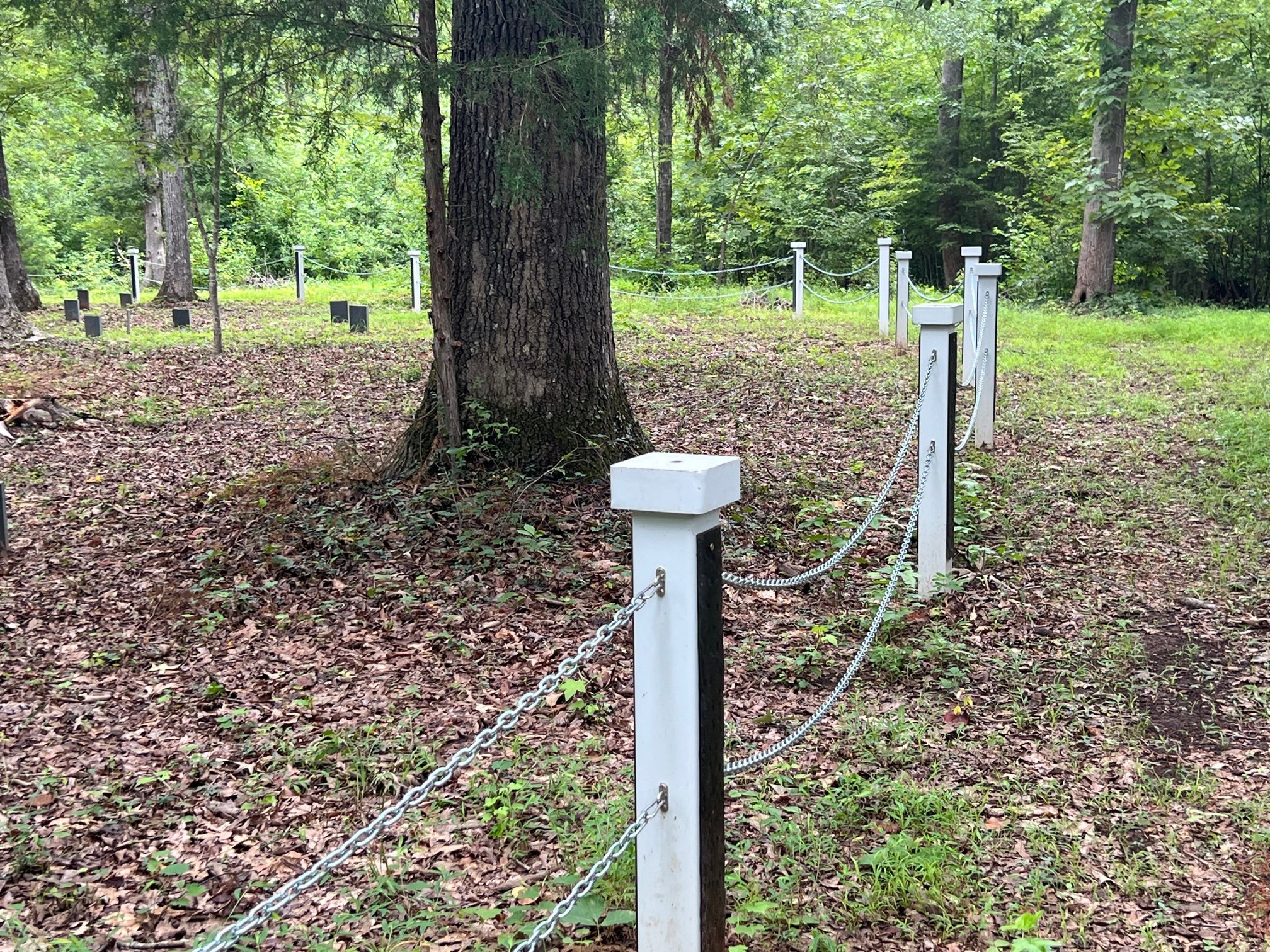
In order to prevent to loss of location of these gravesite, we are working with a local stone carver to create 144 markers that will have the grave number carved into it to be placed in the coming years. Finally, we are creating a fence and gate to set this area apart from the remainder of the property and serve to remind folks of the importance of the cemetery in regard to the history of the surrounding community.
Public access will be encouraged and allowed on a “as needed” or scheduled event each year. This will aid us in ensureing there will be no further disturbance to the site.


Setting the stones
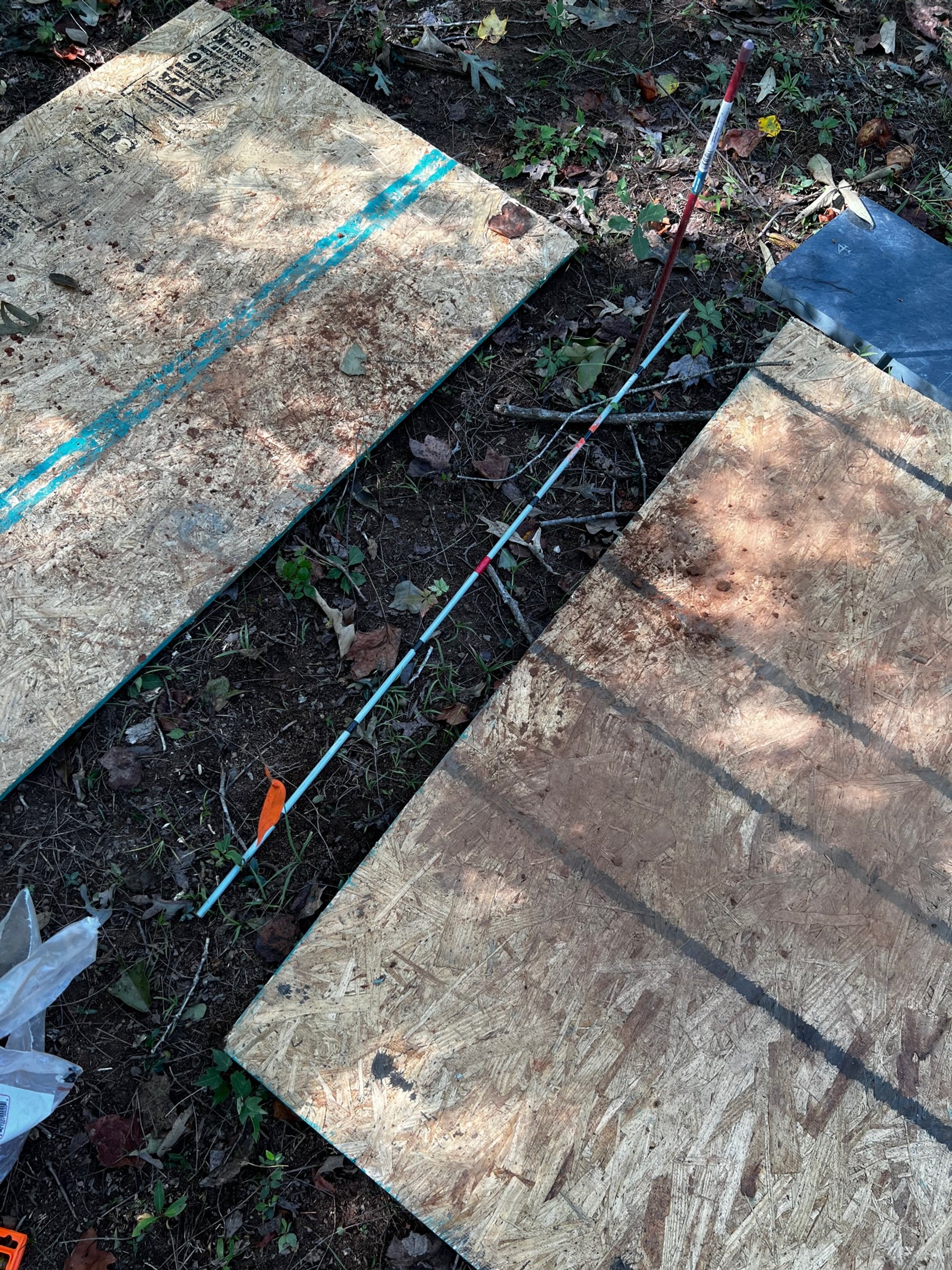
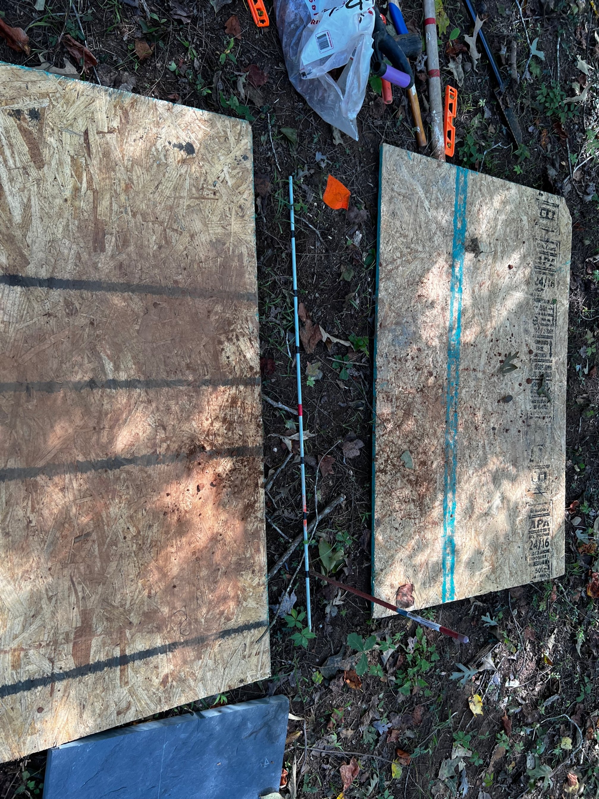
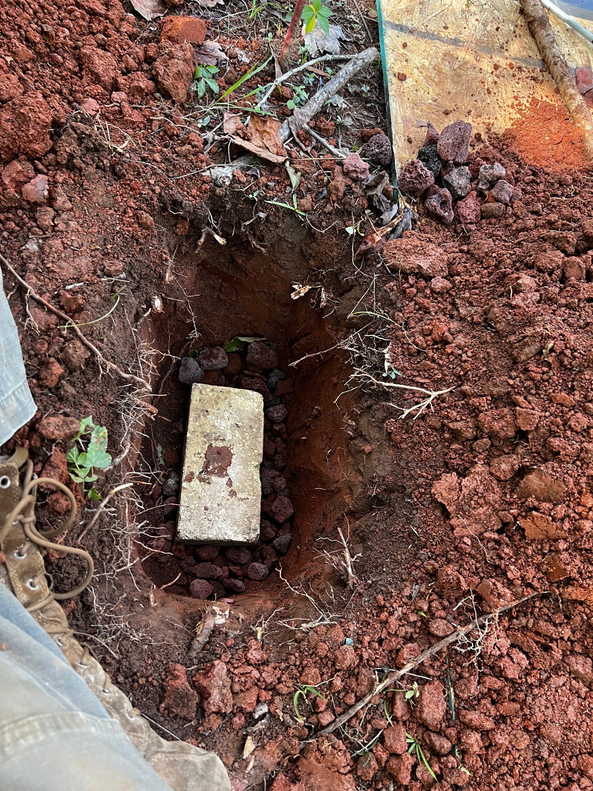
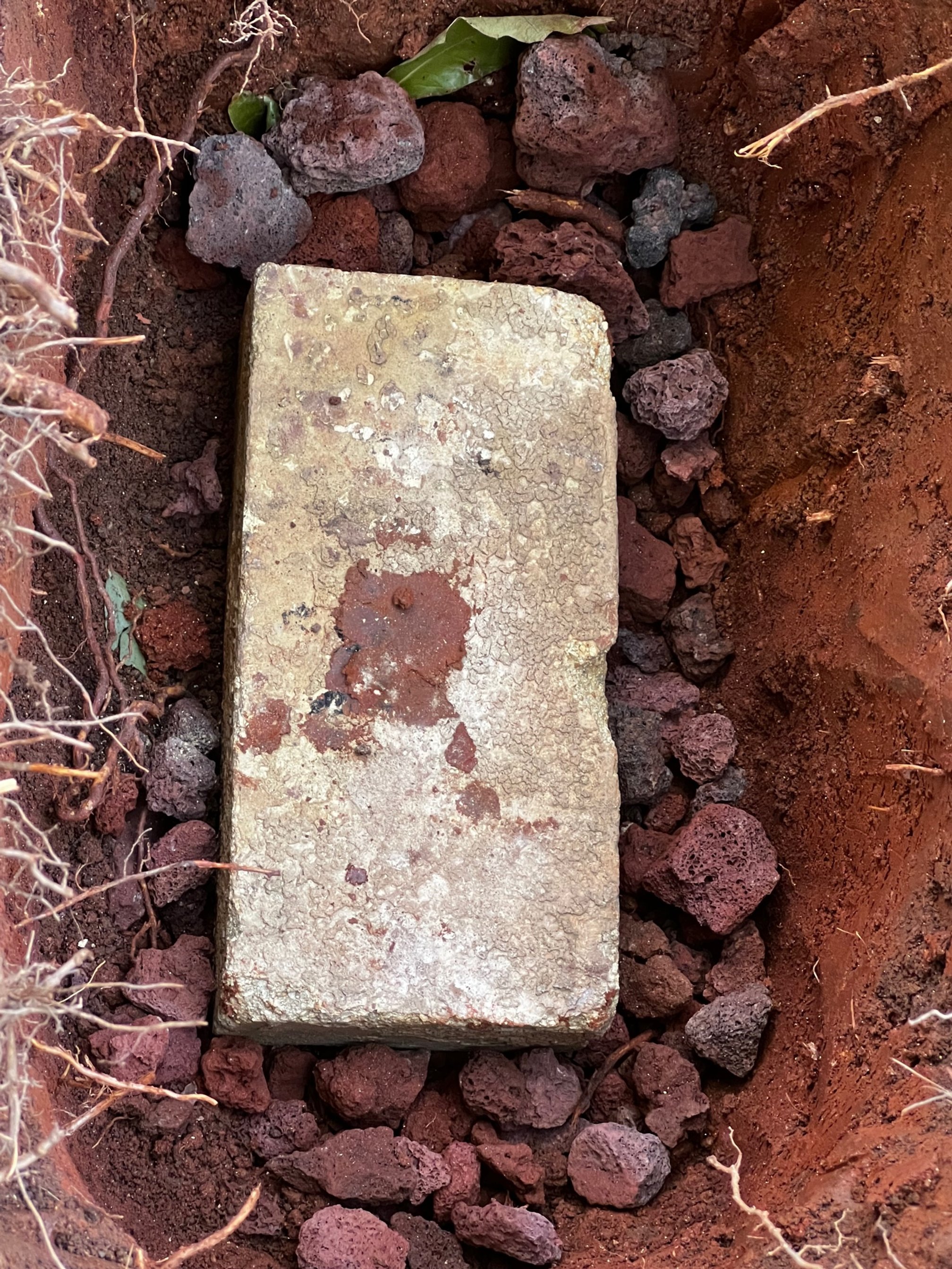
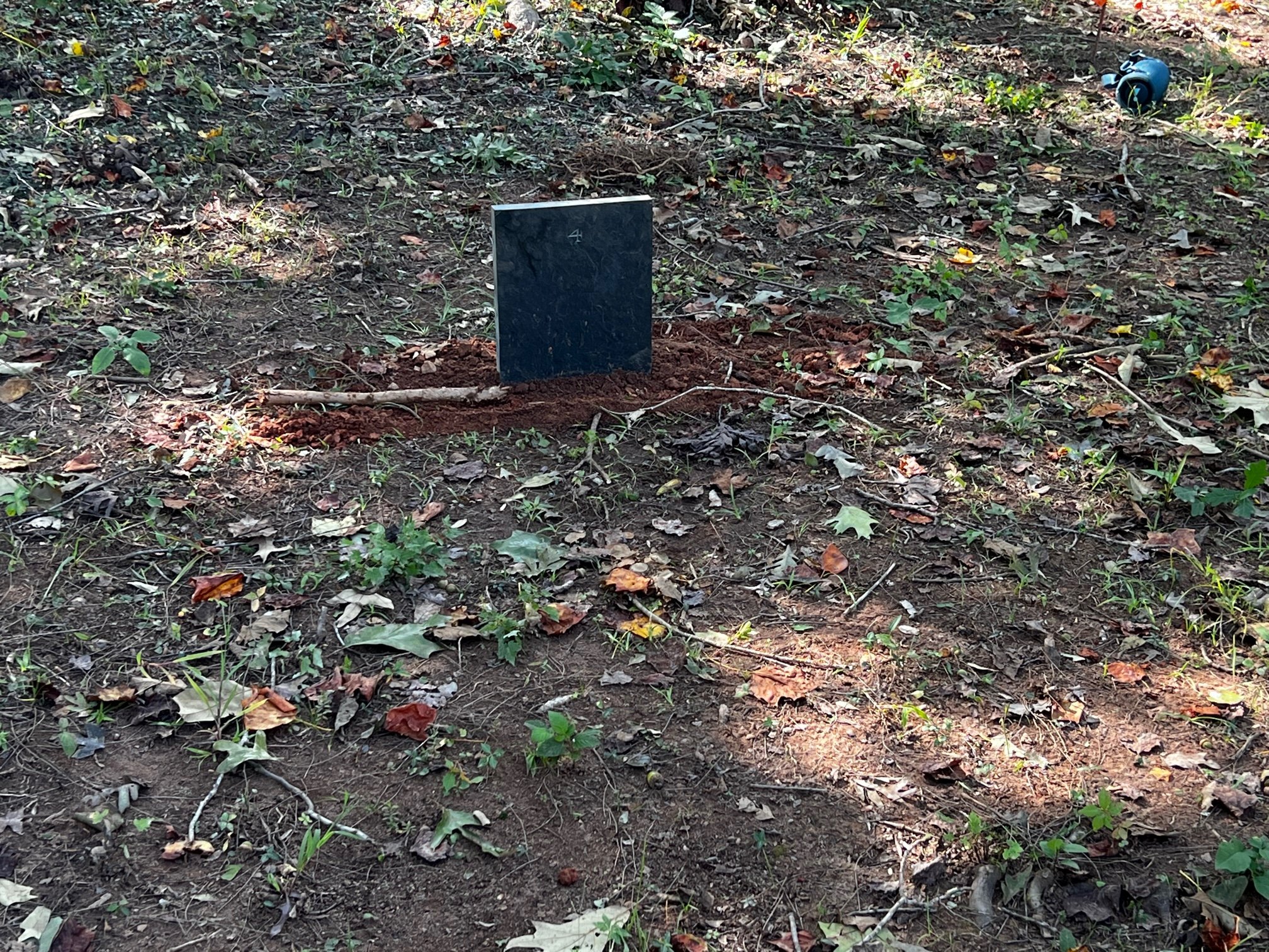
After working with a local stonecutter, we have the 144 stones numbered and ready to be set one the gravesites. Thus far, assuming we don't land right on a root ball, they take 30-45 minutes. David Gillespie, our stonecutter who owns Pumpkintown Primatives, sent great directions for how to properly set each stone to ensure they are stable and long lasting. Basically a hole is dug that has gravel in the bottom and a brick as a foundation. The head stone is then set and centered at the head (west) end of the grave and checked for level as it's backfilled.
We have opted to not "police" up the lines to show how each grave is oriented.
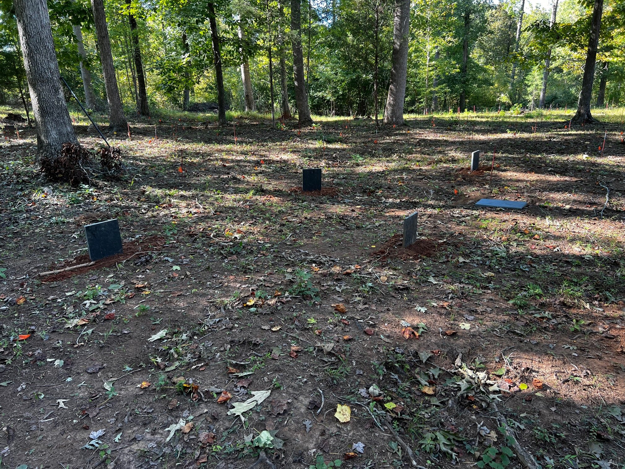
Stones Wrapped up and the Fencing begins.
The final marker stone was placed in February of 2023. As mentioned above, graves that had a prominant stone upon discovery, did not have a numbered marker to keep the area less cluttered. The next part of this project is to construct a perimeter fence and gate to enclose and protect this area. Working with a metalsmith out of Charlotte NC, (Iron Giant Fabrication, Owner Calico Graves) we have designed a fence and gate that will incorperate design elements and symbology that these individuals would pontentially be able to identify. We have used Andinkra sybology that has deeper meanings such as faithfulness, family, remembrance, and learning from the past. The fence and chains are anticipated to be completed by the end of this month.
Gate Design: This is a sketch of the gate design as it stands now. The final design is subject to change and is completion is anticipated by late 2023 - early 2024

In late 2022 and early 2023 the enclosure fence was installed around the perimeter of the cemtery. A white steel post with double chain design was chosen as it will allow for finials of Andinkra design to tie into the gates which are currently under construction.
Update October 2023
So two years into this project we are still coming to grips with the magnitude of what is located on our land. We continue to reach out to academic institutions and museums to seek spreading this information so that other can utilize it. We are wrapping up the design of the gate and hope to begin construction over the holidays as the fabricator is also a college instructor. If everything goes to plan, we should be able to install them in early 2024.